Day 41 - This Trailside Moment is Brought to You By (Someone Already Peed Here) - May 16
This morning was cold and none of us wanted to leave our tents. At least, Matt, Brain Turtle and I didn't want to get up. However, there was a large group of thru-hikers that left around 6 am. They were talking loudly, one joking about how after the AT, he would soak his sleeping bag with a garden hose and sleep in it because he missed it so much.
We eventually got up and hit the trail around 9:30. I had done some math and figured that we needed to hike around 17 miles each day now to get to Agua Dulce when we planned.
As we hiked, it was sunny, but we could see clouds below covering Los Angeles. They seemed to be moving up the mountains toward us. Some other hikers passed us. We reached the first road crossing of highway 2, they were hanging out there at the picnic tables. A guy came up with a small adorable dog. She was so sweet. His name is Steel and the dog is Cora. He has been mostly night hiking with her to avoid the heat of the desert, but today was cool enough for her to hike.
From there, the trail climbed steeply towards Mount Williamson. I had to stop often, climbing that at a steady walk made me breathe hard like I was running. We stopped for a pack off my shoulders break, which turned into a lunch break. An older couple caught up to us and joined us for lunch. Hell-bent and Stop and Go, from Fort Worth, Texas are really nice. She works in a Faye Alice Jones church in Fort Worth and he's 73, but he doesn't look it. I hope I'm still going backpacking at that age.
The summit of Mount Williamson was a short but steep detour from the trail, and 8215 feet in elevation. We went up, took some silly pictures and came back down.
Soon after, there was a trail closure to protect and endangered frog. We walked on the side of Highway 2 instead, which wasn't bad for a roadwalk. There was lots of trash, including a pile of broken sleds at the bottom of a hill leading to large rocks. Thays why you don't sled twarss rocks, kids. The road walk ended at Buckhart Campground and we stopped for dinner. Hell-bent and Stop and Go were there and we had dinner with them. They camped there and we kept going. Brain Turtle's stomach had been bothering her, but it got better after some tea and cinnamon raisin breakfast flats. We walked down Burkhart Trail to Cooper Canyon. There was a small waterfall to the left. We could seeing from the trail, covered in beer drinking dayhikers. I had a trailside moment soon after, waterfalls have that effect on my bladder. Brain Turtle had to stop and adjust her pack, only to find someone had peed in the trail cranny. That trail was so nice and enjoyable, well maintained, slight downhill slope, next to a lovely creek that reminded me of North Carolina. It was strange, when you looked up the ridge, how quickly the lush green landscape changed to dry chaparral. The trail crossed the creek and kept going down. Then we got back on the PCT, which went up to the Cooper Canyon Campsite. That campground is lovely, big trees shading everything and a stream running by.
We ended up hiking only 11.3 PCT miles today, but it was about 12.5 total miles including the extra miles for the alternate and the summit. If we had started a couple hours earlier, I think we could have hit 17 miles. Tomorrow we're planning on getting up and hiking at 7.
We eventually got up and hit the trail around 9:30. I had done some math and figured that we needed to hike around 17 miles each day now to get to Agua Dulce when we planned.
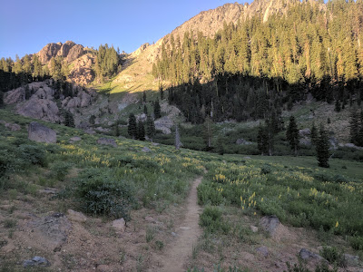
As we hiked, it was sunny, but we could see clouds below covering Los Angeles. They seemed to be moving up the mountains toward us. Some other hikers passed us. We reached the first road crossing of highway 2, they were hanging out there at the picnic tables. A guy came up with a small adorable dog. She was so sweet. His name is Steel and the dog is Cora. He has been mostly night hiking with her to avoid the heat of the desert, but today was cool enough for her to hike.
From there, the trail climbed steeply towards Mount Williamson. I had to stop often, climbing that at a steady walk made me breathe hard like I was running. We stopped for a pack off my shoulders break, which turned into a lunch break. An older couple caught up to us and joined us for lunch. Hell-bent and Stop and Go, from Fort Worth, Texas are really nice. She works in a Faye Alice Jones church in Fort Worth and he's 73, but he doesn't look it. I hope I'm still going backpacking at that age.
The summit of Mount Williamson was a short but steep detour from the trail, and 8215 feet in elevation. We went up, took some silly pictures and came back down.
Soon after, there was a trail closure to protect and endangered frog. We walked on the side of Highway 2 instead, which wasn't bad for a roadwalk. There was lots of trash, including a pile of broken sleds at the bottom of a hill leading to large rocks. Thays why you don't sled twarss rocks, kids. The road walk ended at Buckhart Campground and we stopped for dinner. Hell-bent and Stop and Go were there and we had dinner with them. They camped there and we kept going. Brain Turtle's stomach had been bothering her, but it got better after some tea and cinnamon raisin breakfast flats. We walked down Burkhart Trail to Cooper Canyon. There was a small waterfall to the left. We could seeing from the trail, covered in beer drinking dayhikers. I had a trailside moment soon after, waterfalls have that effect on my bladder. Brain Turtle had to stop and adjust her pack, only to find someone had peed in the trail cranny. That trail was so nice and enjoyable, well maintained, slight downhill slope, next to a lovely creek that reminded me of North Carolina. It was strange, when you looked up the ridge, how quickly the lush green landscape changed to dry chaparral. The trail crossed the creek and kept going down. Then we got back on the PCT, which went up to the Cooper Canyon Campsite. That campground is lovely, big trees shading everything and a stream running by.
We ended up hiking only 11.3 PCT miles today, but it was about 12.5 total miles including the extra miles for the alternate and the summit. If we had started a couple hours earlier, I think we could have hit 17 miles. Tomorrow we're planning on getting up and hiking at 7.

Comments
Post a Comment